How to create a realistic landscape

Hello,
Thanks for taking the time to help.
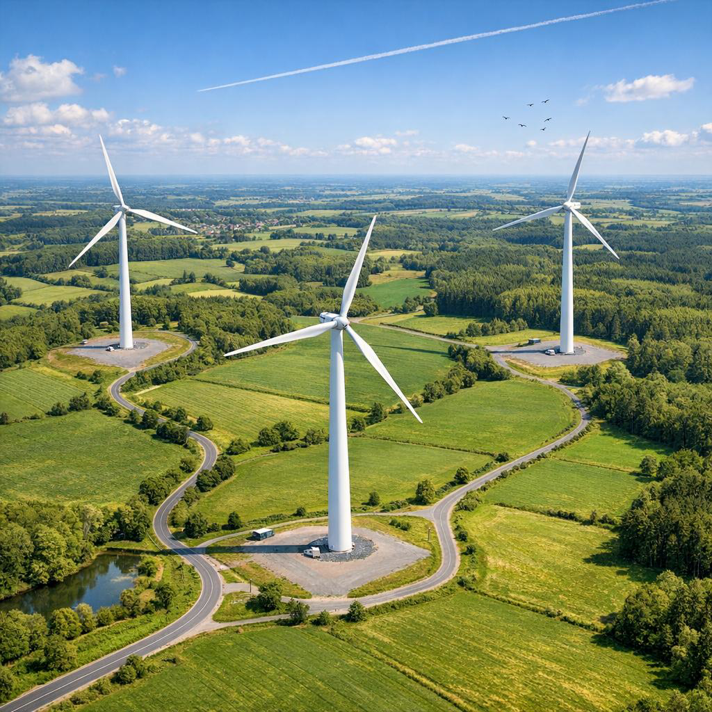
I'm trying to create a landscape similar to the image below. The camera starts roughly 250 meters above the ground, moves toward a wind turbine, then descends vertically to ground level before entering the turbine.
I'm using 3ds Max 2027 with Arnold for rendering.
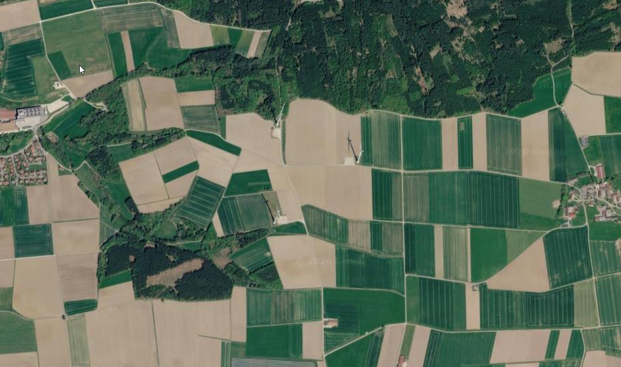
As a reference, I used a similar aerial image and generated a height map from it.

I have access to Forest Pack, but for this project it feels excessive and inefficient at this scale. The environment mainly consists of trees, with grass only needed during the vertical descent near the turbine base and surrounding fields.
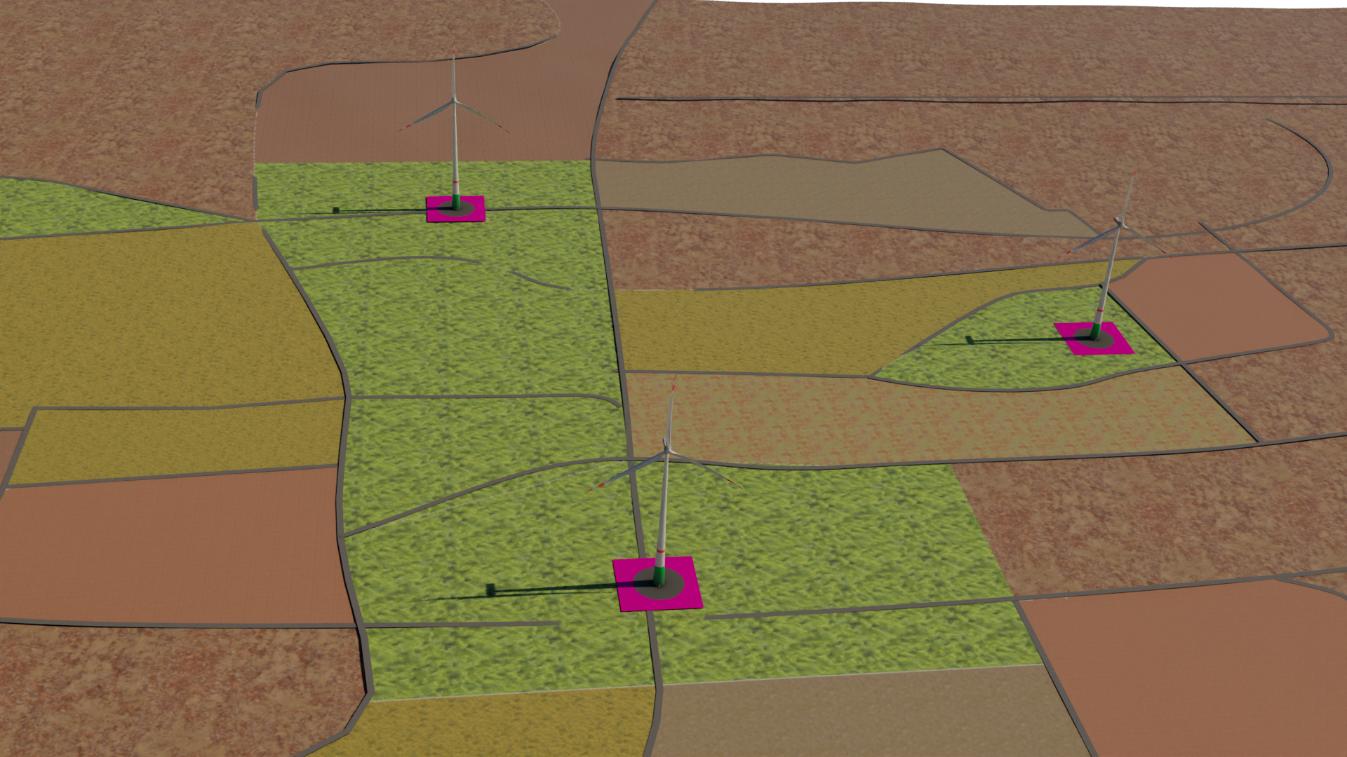
Unfortunately, time is running short, and my current results look terrible. I've experimented with composite nodes and procedural noises (Smoke, Cells, etc.) to break up texture tiling. Textures come from Substance.
At this point, I'm happy to simplify the scene and move closer to the look of the first reference image if that makes the workflow easier and faster.
Any advice, guidance, or workflow suggestions would be greatly appreciated.
Thanks in advance!
Replies
Forest Pack is "just" a scattering tool. You can use basically any geometry and proxies with it (I'd assume that includes Arnold stand-ins), use various manners of area distribution with variation as well as manual placement, you have a camera dependet LOD and lightweight viewport representation. Depending on how short "time is running short" actually is and if you aren't totally unfamiliar with it, I'd say it would be pretty useful for something like this, at least if you want something in the visual fidelity and detail like your reference image.
The free included tree models aren't too great, though, but from a distance it might work. But like said, you can source models from pretty much anywhere. Too steep an angle might also be a problem for the included billboards, in case you want to make use of those, but that's more something for the far distance anyway.
For procedurals with a nice organic look out of the box, the OSL noises (e.g. Uber Noise, but there are others) are pretty handy, e.g. if you want to break up two maps. Some of them can get a bit crash happy, especially in more nested materials, which can also add significant render time, but if you just want to use a noise as a mask for blending, it should be fine. Of course you can also use some (nested) standard noises.
Also some UVW randomization, but for fields, you want some directionality and would have to be able to limit that to 180 degree increments, which also limits the usefulness.
Alternatively, you can just randomize between various tiling variants of the same texture per tile (I assume there's an OSL or perhaps even Arnold map for that, too), but that would require to create those first.
The easiest solution might be to simply have big texures that cover a lot of area uniquely and only switch to close up ones were necessary. Also, ideally and closer to the camera, foliage will hide a lot of it.
What does the height map look like and what is it for? Overall landscape relief, per field / transition road to field, finer surface structure? The aerial image doesn't really seem to lend itself for any of that without a lot of work, unless perhaps inverted to get a rough sense of where fields and streets are.
thank you very much for assisting!
The height map (attached) itself is also fairly flat, which is typical of much agricultural landscape. It's not especially dramatic terrain, but it does suit the wind farm environment well.
With the reference image as the primary visual target, what would be the best approach for creating fields that look like that without incurring the significant geometry overhead associated with Forest Pack grass clusters?
My initial thought is that, since the camera remains relatively distant, a texture-driven approach might be more efficient than scattering large amounts of geometry. I'm interested in understanding how you would typically achieve that level of realism while keeping the scene lightweight and Arnold GPU-friendly.
Thanks Noren!
Either way, there is not much going on / necessary in ways of reflections or GI in this scene and you might be able to get a reasonably fast render on CPU as well. Make sure to opt for a cheap solution for aerial perspective.
Is the displacement map already applied in the render? Then I'd probably get rid of it. Even if it isn't, your reference is basically flat. You could add some slight hills for added visual interest, but unless your sun is really low, you'd need overlaps/intersections and so a quite noticable relief. Subtle large scale height variations are probably not worth the trouble.
Medium level slopes/embankments of the roads and around the fields are much more important. Could be modeled as well.
Higher strips of vegetation, high grass/plants breaking up the edges of fields or hedges even at medium distance, even if the bigger areas are empty (bump maps / normal maps might be enough for some structure there). A lower sun might help here as well.
Just try to find out ahead of time which level of detail you actually require (resolution, motion blur etc., motion blur might hide more detail the closer you get to the ground). But generally and if required, I'd use scattered grass at least near the camera.
And, like said, try to get maps in the appropriate size. You don't want a texture for 3x3 m of soil and then struggle to hide the tiling. You want a map that's a quarter or half a field or maybe even several fields if you can get an arial view in decent enough resolution and quality. (That's not to say it's impossible with smaller textures, it's just a lot of unnecessary work for areas you'll never see up-close.)
Also, and no offense, if time is short and you find yourself struggling already, then now would be the time to consider outsourcing this if that's an option and this is in any way critical.
I used to work for a viz company that specialized in windfarms and large infrastructure projects. I learnt the hard way (by going over budget) that high detail rendering and complex materials were completely wasted on the target audience of engineers, project managers and executives. Times may have changed and expectations may be higher these days, but you might need to think about what's important and reduce your scope.
In terms of the landscape texture I'd incorporate the aerial photography into your material. Build your own normal/bump map for it (ie: define roads etc) and blend those with your tiling textures.
@Noren Thanks for the information — it's all very useful. From an aerial perspective, the landscape is quite flat. On the ground there are a few subtle bumps and variations, but not much at all. I won't remove it now, as I've already positioned the roads based on the height map, but it's definitely a good suggestion for next time.
I’ll also be adding some small hills around the outside of the map to help break up the horizon. Thanks again for your input!
@Benjammin Cheers for jumping in. The main asset is inside the turbine, so I'm not too concerned about the landscape being absolutely perfect, with beautiful vegetation variations down to the smallest detail. That said, the way it looks at the moment is pretty horrendous.
I'm currently experimenting with a few different approaches, and I'll definitely try incorporating the aerial photography into the ground material. I already have it set up as a reference for the road layout, so it should be fairly straightforward to build on that. Thanks for the suggestion!